Accessing GIS software
How to get ArcGIS Pro on your computer
Three ways to access ArcGIS Pro
This class uses a software called ArcGIS Pro. It’s a proprietary GIS software, created by a company called Environmental Systems Research Institute or Esri. They are the proverbial 800-pound gorilla in the GIS lab. There are many other important geospatial toolkits out there, but because Esri tools are used so ubiquitously across the public and private sectors, I think it’s important from a professional development perspective to have some training with them as part of your foundational GIS experience.
ArcGIS Pro isn’t the kind of software that you get through individual licenses, so it’s worth becoming familiar with the free, open-source GIS tools as well. QGIS is the proverbial 800-pound gorilla in the open-source GIS lab. QGIS is basically a graphical user-interface for GDAL, which you can also use via Python or the command line. And JavaScript libraries like Leaflet and OpenLayers are great approaches for open-source web mapping.
Regardless of which software you end up using the most, if you stick with GIS work, one thing is certain: someday, at a party, you will sheepishly explain your job to a stranger by saying, “It’s like Google Maps, but with more layers.” When your time comes, I only that you are not surrounded by vampires.
Anyhoo: three ways to access ArcGIS Pro!
Way #1: Just go to the Spatial Analysis Lab
This is by far the easiest way to use ArcGIS Pro, and it’s the one I recommend: just go to the SAL. It’s in INTC 300. There are a bunch of computers, you use your credentials to log in, and you work on labs and whatnot. Student assistants will be there to help you troubleshoot. It’s nice to have the community while you work.
You need a code to access the SAL! It is 25874.
Way #2: Access via remote desktop protocol
The Remote Desktop Protocol (or RDP) allows you to remotely access a machine on UR’s campus, even if you are not physically on campus. This is really handy if you’re in a pinch and can’t come to the SAL in person. The downsides are (1) RDP is a little slow and (2) it takes some time to get set up correctly. I think it’s worth setting up, especially if you will routinely need to use lab computers in future classes. This short tutorial assumes you are not on campus or connected to the campus wifi:
If you are using a Mac: Download this app from the App Store
Follow these instructions to set up a VPN (you can only use the RDP if you are also using a VPN)
Activate the VPN using the Cisco Secure Client app (you’ll need to log in/do 2FA using your NetID)
Follow this link to the
General_Use_Labs: https://bigpine.richmond.edu/maps/stdYou should see a page that resembles the screenshot below. Click anywhere into the bar labeled
ACS.JPS.URLAB.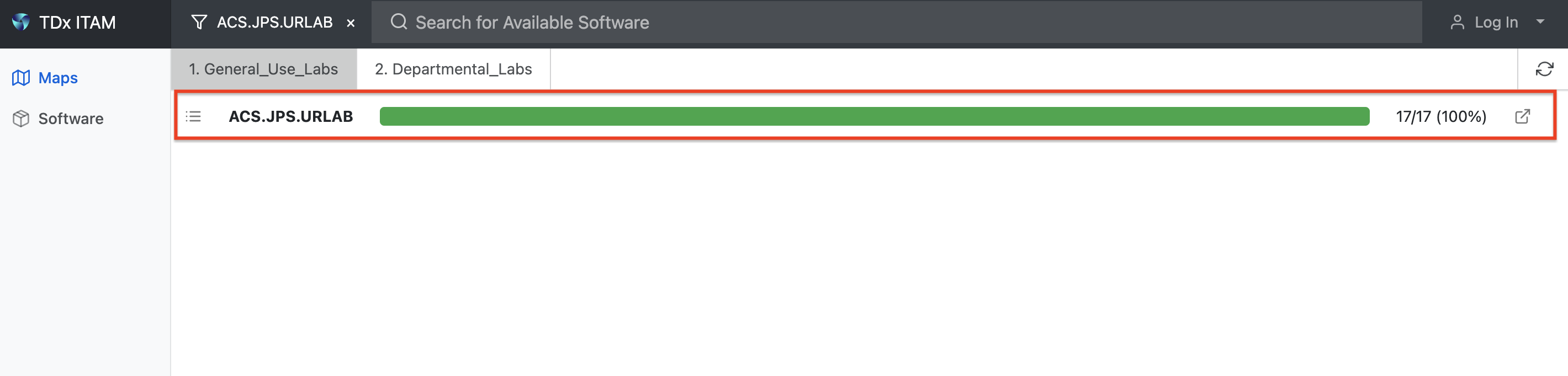
Figure 1: Click anywhere inside the red box Now, choose one of the available computers and click “Connect”:
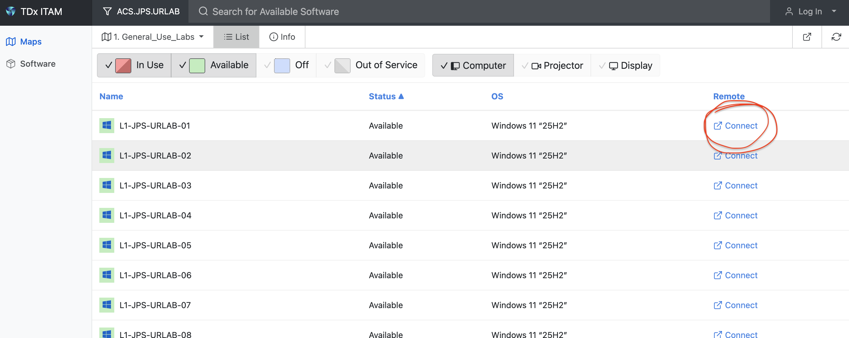
Figure 2: Pick a computer by clicking “Connect” An RDP file called
connect.rdpwill begin downloadingOpen
connect.rdpLog in using the NetID version of your email address; for example, I use
ispangler@richmond.edu, notian.spangler@richmond.eduYou should now be successfully hacked into the mainframe, as it were. Kudos!
Way #3: Download the software (Windows only)
For dumb computer reasons that you can read about on internet forums if you want, ArcGIS does not and probably will not ever run on Macs. If you have a Windows machine, installing it isn’t complicated; try following these instructions, and if you bump into problems, reach out to the Computer Help Desk at helpdesk@richmond.edu.
A word of caution if you are downloading the software! If you want to download ArcGIS Pro and work from your personal computer, you’ll need a flash drive or access to hemisphere—the shared GIS storage network—in order for your spatial data and project files to be persistently stored across devices. Follow these instructions on .